Ruthin Forest Resource Plan – Approved 23 October 2023
Location and setting
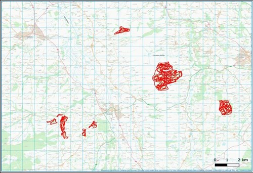
Ruthin Forest Resource Plan (FRP) includes eight forest blocks which has a total area of 749 ha. Overall, the plan area is predominantly coniferous, though some individual blocks contain high proportions of broadleaves. The blocks are spread across and area of roughly 100 km2 around the towns of Mold, Ruthin and Denbigh, with the three easternmost blocks – Moel Famau, Nercwys and Llangwyfan – lying within the Clwydian Range and Dee Valley Area of Outstanding Natural Beauty (AONB). All the blocks apart from Llangwyfan lie within 4 km of the A494 road, which runs north-east through the plan area. Moel Famau is the largest block at 428 ha, which lies on the upland spine of the Clwydian Range roughly halfway between Ruthin and Mold.
The surrounding habitat of the Ruthin FRP blocks consists of enclosed grazed farmland and open moorland, commercial conifer forest blocks, generally located on the higher elevations, with mixed conifer/broadleaved woodlands on the lower slopes and riversides. The large Clocaenog forest, also managed by NRW, lies to the west of Ruthin FRP. All the Ruthin forest blocks are dedicated for open access on foot under the CRoW Act and also allows access for horse and cycles on a permissive basis. There is a network of Public Rights of Ways that connects the blocks to the wider landscape, with the Offa’s Dyke long distance trail running along the edge of the Moel Famau and Llangwyfan blocks.
Ruthin Forest falls into six different river catchments as defined by the Water Framework Directive. All of these catchments fall within the larger Clwyd and Dee catchments, and of the six, two hold a ‘Good’ overall status, two a ‘Moderate’ overall status and two a ‘Poor’ overall status.
Summary of objectives
The following management objectives have been agreed in order to maintain and enhance the resilience of ecosystems, and the benefits they provide:
- Removal of larch and diversify the forest species composition to increase resilience to pests and diseases whilst building a robust forest for future generations.
- Continue to maintain a sustainable supply of timber production through the design of felling and restock species choice.
- Increased successional/ riparian woodland and broadleaved areas for the improvement of habitat resilience and landscape scale habitat linkages.
- Identify and protect important heritage features, including the historic natural environment.
- Continue to identify and restore ancient woodland site features and areas of conservation interest.
- Maintain and improve visitors experience by providing a safe and enjoyable diverse environment.
Maps
Long-term vision:
Forest management & felling strategy:
Forest types & restocking:
Comments or feedback
If you have any comments or feedback, you can contact the Forest Resource Planning team at frp@naturalresourceswales.gov.uk.