
Beacons View, near Monmouth
Walk through heathland and woodland

Dinas Rock is an imposing limestone cliff in Waterfall Country on the edge of the Bannau Brycheiniog (Brecon Beacons) National Park.
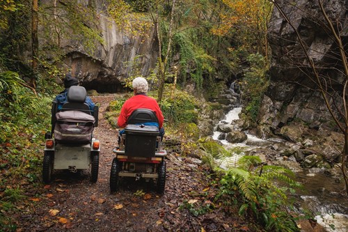
There is a short accessible trail from the car park to the cascades.
The other waymarked walking trail goes to Sgwd yr Eira waterfall.
You can also walk to the nearby former gunpowder works - see the information panel in the car park for the suggested route.
The car park here can get full as this area is popular with outdoor activity groups.
Dinas Rock is in a popular part of the Bannau Brycheiniog National Park known as Waterfall Country.
We want you to return home safely after your visit to Waterfall Country.
Serious accidents do happen to visitors here and there have been several fatalities in recent years.
You are responsible for your own safety as well as the safety of any children and animals with you during your visit.
Please note:
For advice and tips to help you plan your visit here go to Visiting our places safely.
The walking trails are waymarked from start to finish.
Look out for the information panel at the start of the trails.
Find out about walking trail grades.
The Sychryd Trail winds its way alongside the river through a narrow wooded gorge.
The huge rock known as Bwa Maen, an impressive geological fold, is on the other side of the river.
The trail reaches the Sychryd cascades before returning along the same path.
This trail’s destination is the famous Sgwd yr Eira waterfall (which means “fall of snow” in Welsh).
The trail passes Dinas Rock hillfort and the old gunpowder works, and returns to the car park along the same route.
You can also walk to Sgwd yr Eira and three other waterfalls on the Four Falls Trail from the car park at Gwaun Hepste.
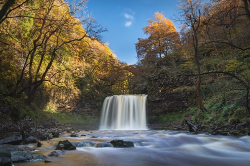
Nowhere else in Wales is there such a richness and diversity of waterfalls within such a small area as Waterfall Country.
Here the rivers Mellte, Hepste, Pyrddin, Nedd Fechan and Sychryd wind their way down deep, tree-lined gorges, over a series of dramatic waterfalls, before joining to form the River Neath.
Whether you are looking for a whole day adventure or an hour’s stroll you should be able to find a route suitable for you.
Waterfall Country lies largely within woodland jointly managed by Natural Resources Wales and the National Park Authority. Together we manage the paths and help you explore and enjoy this unique area.
Go to the National Park's website for more places to visit in Waterfall Country.
Please check the top of this webpage for any changes to these opening times.
The car park is open from 8am to 5.30pm or dusk whichever is sooner.
See the top of this webpage for details of any planned closures or other changes to visitor facilities here.
For your safety, always follow instructions from staff and signs including those for trail diversions or closures.
We may divert or close trails whilst we undertake maintenance work or other operations and we may need to close other visitor facilities temporarily.
In extreme weather, we may close facilities at short notice due to the risk of injury to visitors and staff.
You may need permission from us to organise an event or to carry out some activities on our land.
Check if you are allowed to use our land.
Dinas Rock car park is 13 miles north east of Neath.
The postcode is SA11 5NU.
Please note that this postcode may not take you to the car park if you use a sat nav or navigation app.
We suggest you follow the directions below or use the Google map on this page which has a pin on the car park’s location.
Take the A465 from Neath towards Merthyr Tydfil.
Leave the A465 at the exit for Glynneath and the A4109.
At the end of the slip road, follow signs for the B4242 and Pontneddfechan.
Follow the brown and white signs for Dinas Rock through the village.
Take the right fork immediately after the former Dinas Inn and continue for one kilometre.
The car park is beyond the bus turn-around point after crossing the narrow bridge over the river.
View this place on the What3Words website.
The Ordnance Survey (OS) grid reference for the car park is SN 911 079 (Explorer Map OL 12).
The nearest mainline railway station is in Aberdare.
For details of public transport go to the Traveline Cymru website.
Parking is free of charge.
The car park can get full as this area is a popular destination for groups from outdoor activity centres.
Please note the car park opening times in the opening times section above.
There is a barrier at the car park entrance when it is closed.
Overnight parking is not permitted.
There are no staff at this location.
Contact our customer team for general enquiries during office hours, Monday to Friday.


