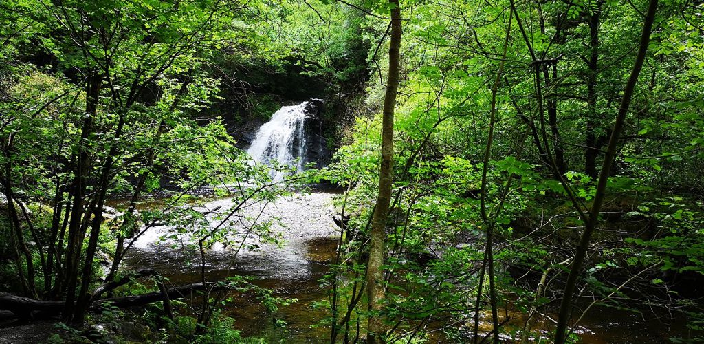
Beddgelert Forest, near Beddgelert
Huge forest in the heart of Eryri (Snowdonia)...

The Rhaeadr Ddu Waterfall Walk is closed due to a dangerous bridge.
Ceunant Llennyrch is a spectacular deep, wooded gorge with cliffs that are eighty feet high and only thirty feet apart at some points.
Between the gorge's high walls, the Afon Prysor river cascades and tumbles steeply down towards the Dwyryd valley.
The gorge is home to many spectacular waterfalls including the Rhaeadr Ddu (black waterfall) which you can see on our strenuous walking trail.
The oak woodland here is a remnant of a vast Celtic rainforest that once extended down the western side of Britain and Ireland.
The mild but wet climate, with rainfall throughout the year and a constant spray from the many waterfalls, and the dense canopy dominated by oak ensure high humidity within and around the gorge, creating a bonanza for damp-loving plants.
The walking trail is waymarked from start to finish.
Look out for the information panel at the start of the trail.
Find out about walking trail grades.
Take in the ‘rainforest’ atmosphere of this ancient oak woodland and look out for the many shapes and colours of lichens on trees.
Marvel at the deep ravine and feel the spray from the Rhaeadr Ddu waterfall.
Ceunant Llennyrch is a National Nature Reserve.
National Nature Reserves are places with some of the very finest examples of wildlife habitats and geological features.
The landscape and wildlife varies depending on which time of year you visit – here’s what to look out for.
Plants thrive in this humid environment, and there are 230 species of mosses and liverworts at Ceunant Llennyrch, many of them uncommon or rare.
Look out for the graphically named prostrate feather moss, the silky swan-neck moss and the aptly named cushion moss, with its elephantine cushions on the edge of crags and boulders.
Knowing the names isn’t essential, just look at the variety of shapes of mosses on the woodland floor, the crags and boulders and the tree trunks.
Ceunant Llennyrch, with its pure air, is one of the richest woodland lichen sites in Wales.
With almost 250 species, including many nationally rare species, it is comparable with the ravines of western Scotland - internationally famous for their lichen communities.
The woodland sustains a healthy bird population.
Notable summer visitors include redstart, wood warbler and pied flycatcher – the typical ‘upland oakwood’ species.
There are over 70 National Nature Reserves in Wales.
Find out more about National Nature Reserves.
Ceunant Llennyrch is one of six large Meirionnydd Oakwoods which are protected as National Nature Reserves.
These oakwoods are as globally important and as vulnerable as some tropical rainforests and are a remnant of a vast Atlantic ’wildwood’ that once extended down the western side of Britain and Ireland.
Two of the other Meirionnydd Oakwoods may be visited with care:
Dense vegetation and steep access mean that the other three Meirionnydd Oakwoods (Coed Camlyn, Coed Cymerau, and Coed y Rhygen) are not suitable for visitors.
Ceunant Llennyrch is in Eryri (Snowdonia) National Park.
Eryri is the largest National Park in Wales and is home to picturesque towns and villages and the highest mountain in Wales.
It is looked after by the Eryri National Park Authority.
For more information about visiting Eryri (Snowdonia) go to the Eryri National Park Authority website.
We want you to return home safely after your visit here.
You are responsible for your own safety as well as the safety of any children and animals with you during your visit.
Please note:
For advice and tips to help you plan your visit here go to Visiting our places safely.
See the top of this webpage for details of any planned closures or other changes to visitor facilities here.
For your safety, always follow instructions from staff and signs including those for trail diversions or closures.
We may divert or close trails whilst we undertake maintenance work or other operations and we may need to close other visitor facilities temporarily.
In extreme weather, we may close facilities at short notice due to the risk of injury to visitors and staff.
You may need permission from us to organise an event or to carry out some activities on our land.
Check if you are allowed to use our land.
Ceunant Llennyrch National Nature Reserve is 8½ miles east of Porthmadog.
The postcode is LL41 4EU.
Please note that this postcode may not take you to the parking area if you use a sat nav or navigation app.
We suggest you follow the directions below or use the Google map on this page which has a pin on the parking area's location.
Take the A487 from Porthmadog to Maentwrog.
Turn right just before the church and go into the village, following the signs towards Harlech and the A496.
After about 1 mile turn left uphill onto a minor road.
Follow this singletrack road for about ¾ mile to the small parking area just off the road.
View this place on the What3Words website.
The Ordnance Survey (OS) grid reference for the parking area is SH 664 392 (Explorer Map OL 18).
The nearest mainline railway station is in Penrhyndeudraeth.
For details of public transport go to the Traveline Cymru website.
The parking area is not managed by Natural Resources Wales.
There is an honesty box for payment.
Please note that the parking area is small and can get full as this area is a popular destination for outdoor activity groups.
There are no staff at this location.
Contact our customer team for general enquiries during office hours, Monday to Friday.